Shoreline Adaptation Plans
A panorama of Auckland at sunrise
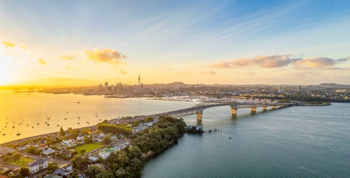
The Auckland region has about 3,200km of coastline and encompasses three main harbours: the Kaipara, Manukau and Waitemata.
Much of the city’s urban development and supporting infrastructure is concentrated in coastal areas and is exposed to coastal processes such as erosion and inundation. In addition, climate change related to greenhouse gas emissions is contributing to rising sea levels, the impacts of which include increased frequency and magnitude of coastal hazard events.
In 2017, the Auckland region adopted a Coastal Management Framework that acknowledged the need for a prioritised, strategic approach to coastal management and recommended the development of Shoreline Adaptation Plans (SAPs). These SAPs give effect to the New Zealand coastal policy statement and align with Coastal Hazards and Climate Change: Guidance for Local Government, published by the Ministry for the Environment.
To support the holistic development of SAPs, the Auckland region was divided into 12 coastal cells – defined areas where sediment movement is expected to be contained or restricted by key geomorphic features, for example between large headlands or within harbours.
The plans consider the potential effects of coastal erosion, coastal inundation, rainfall flooding and climate-change impacts (including sea-level rise) in each cell. They seek to provide an adaptive planning approach that is focused on the needs and values of iwi (Maori communities) and local communities. The SAPs also work to promote the preservation, enhancement and ecological restoration of the coastal environment for future generations.
Whangaparaoa SAP pilot
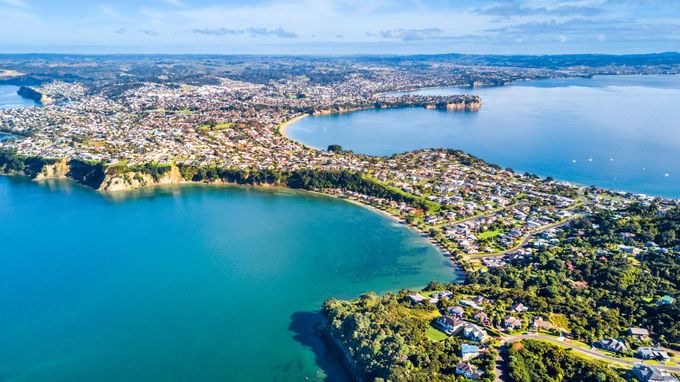
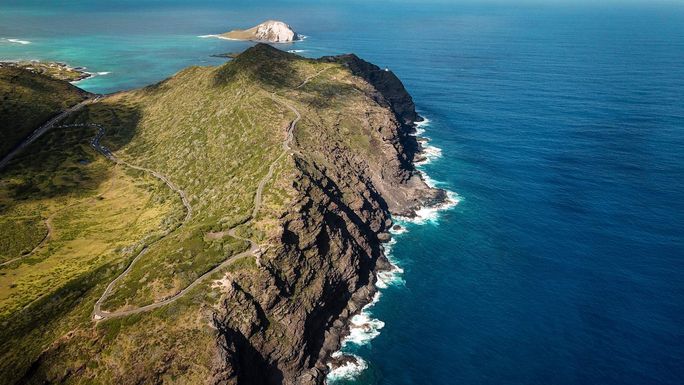
Whangaparāoa Peninsula
The first SAP to be developed under the Auckland Coastal Management Framework covers the Whangaparāoa Peninsula. It has been developed as a pilot to trial best-practice processes for mana whenua (the indigenous Maori people who have historic and territorial rights over the land) and community engagement, coastal hazards assessment and the establishment of long-term adaptation strategies.
Whangaparāoa was chosen because it has a variety of coastal environments, a mix of Auckland Council-owned land and assets, and strong, established communities. The peninsula has also had historical issues with coastal hazards, with both north and south Whangaparāoa identified as ‘coastal hotspots’ in the Coastal Management Framework.
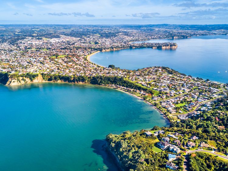
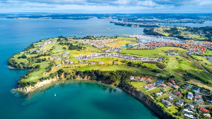
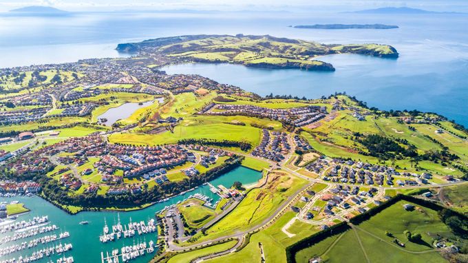
Whangaparaoa context
Whangaparāoa Peninsula is approximately 25km north of central Auckland and is bounded by the Ōrewa Estuary to the north and the Weiti River to the south. It extends 11km into the Hauraki Gulf and has a diverse shoreline, including a mix of sandy beaches such as Stanmore Bay Beach and Te Haruhi Bay, high, steep cliffs such as Tarihunga Point, and modified coast such as Gulf Harbour Marina. The proximity of Whangaparāoa to central Auckland makes it a popular place to live and visit.
Map of Whangaparaoa’s coastline

The entire length of Whangaparāoa’s coastline is susceptible to coastal instability and erosion to some degree. Northern beach areas are particularly exposed and susceptible to periodic erosion from storm events.
Flooding varies across the peninsula, but flat, low-lying areas are at significant risk of coastal flooding, with increasing pressure over time from sea-level rises. These areas are also exposed to rainfall flooding impacts as the catchments across the peninsula drain towards the coast.
Various intertidal habitats, wetlands and dunes exist along Whangaparāoa’s coastline, as well as artificial structures, including sea walls, rock revetments and boat ramps. Sections such as Gulf Harbour have been modified through reclamation, dredging and the construction of large rock breakwaters.
Adaptation strategies
For the Whangaparāoa SAP, the coastline was broken down into 35 ‘coastal stretches’, based on coastal processes, public land boundaries and infrastructure considerations. A high-level strategy was developed for each stretch over the short (0-20 years), medium (20-60 years) and long (60 years plus) term, with an indication of how these choices reflected the escalating risk, the considerations of infrastructure providers and the values and objectives of mana whenua and the local community.
The four main adaptation strategies are:
- No active intervention (NAI) – Natural processes are allowed to continue. This includes no investment in the provision or maintenance of any defences. This strategy is automatically selected for areas of the coastline that are not owned by Auckland Council.
- Limited intervention (LI) – Limited works are undertaken to extend the life of existing assets or to ensure they remain safe, including localised retreat of individual assets. This approach acknowledges that the coastline’s position will not be fixed into the future and may include small-scale, nature-based measures (such as dune planting) to support its resilience.
- Hold the line (HTL) – The coastal edge is fixed at a certain location, using nature-based options (e.g. beach nourishment) or hard structures (e.g. sea walls). Nature-based options are the preferred method where possible.
- Managed retreat (MR) – Assets and activities are moved away from hazard-prone areas over time in a controlled way. Managed retreat allows greater space for natural buffers and reduces the exposure of assets to natural hazards.
The recommended strategies for each of the 35 coastal stretches can be viewed in the graphic below.
The coastal stretches of Whangaparaoa

Historical and cultural context
Whangaparāoa has been a site of Māori occupation for several centuries. Two Māori iwi (communities) – the Ngāti Manuhiri and Ngāi Tai ki Tāmaki – provided values to underpin coastal management on the peninsula, which are categorised into three main themes: whakapapa – ancestry; taiao – environment; and tangata hononga – connecting people. The adaptation strategies for each section of the peninsula have been developed in alignment with these values.
Whangaparāoa Peninsula
Whakapapa (ancestry)
Acknowledging and supporting the cultural and spiritual values and heeding the views of mana whenua regarding culturally significant sites or areas in any coastal management or engineering options.
Taiao (environment)
Priorising naturalisation of the shoreline and working to enhance and protect the natural environment – this includes restoration of the natural environment in areas where managed realignment has been recommended and considering nature-based options in areas adopting 'hold the line' strategies.
Tangata hononga (connecting people)
Recognising and supporting the interdependence of people and their environment, providing mana whenua with kaitiaki (guardianship) opportunities, and working with the local community on volunteering opportunities.
Community engagement
Whangaparāoa Peninsula
In addition to engaging with the iwi, the Whangaparāoa pilot included a range of public outreach events and the establishment of a Community Reference Group. Events included three public presentations to introduce the SAP process and the key concepts of climate change, coastal hazards and adaptation planning – these were live-streamed and recorded; two workshops with the Community Reference Group; and two open days.
Digital engagement was undertaken using the Social Pinpoint online engagement platform, which allows users to drop pins, write comments and complete surveys on an interactive map. More than 500 people participated in the digital engagement, sharing how they made use of public spaces in the area. Some comments, assigned to various places on the map, are shown below.
The Gulf Harbour hammerhead has great views and is a camping spot for self-contained camper vans. My family visits to view the stingrays that frequent the marina. It's crucial that this area stays in public ownership or at least with spacious public access
It is wonderful to be able to walk to the beach from home to relax or watch the sun set or rise
I used to fish here as a kid 40 years ago – the area has changed hugely, with so much mud coming down the river and mangroves extending out with the build-up of mud
This bit of coastline has some amazing geomorphological features such as sandstone that is twisted and convoluted – this is very cool and creates a great habitat for sea creatures, but unfortunately it has been thrashed by fishers
This is approximately where the Weiti [bridge] crossing is to happen. This must go ahead as soon as possible. The current attitude towards high-density housing means it cannot be delayed
The Community Reference Group included 10 community members, aged between 25 and 70, from a variety of backgrounds, supported by two members of the Hibiscus and Bays Local Board.
The engagement process identified the local community’s priorities as:
- Preserving and enhancing the natural environment and ecosystems that support biodiversity
- Using natural and nature-based solutions to increase the resilience of coastal systems where practicable
- Providing diverse recreation options in the Whangaparāoa park and open space network
- Providing safe access to the Coastal Marine Area for a range of water-based activities on the northern and southern sides of the peninsula, such as swimming, sailing and boating, kiteboarding and surfing
- Having accessible places within reserves where people can enjoy the coastal environment in its natural setting
- Shoreline management options should provide added benefits to amenity and coastal access
- Auckland Council to identify opportunities to work with community volunteers to assist with the naturalisation of the coastline
Guidance for Auckland Council asset owners and planners
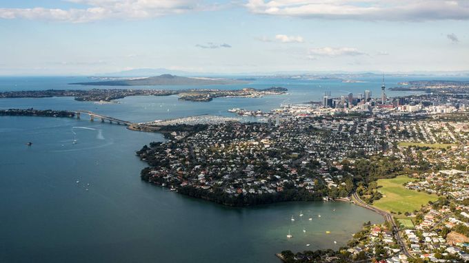
Auckland's harbour and centre
Auckland’s SAPs are initially focused on Auckland Council-owned coastal land and assets, including:
- Parks and community facilities, such as coastal defences; public amenity assets, such as boat ramps; and coastal access, for example walkways
- Stormwater assets, such as stormwater pipes and culverts
- Environmental assets that provide a valuable habitat and buffer from coastal hazards – for example, beaches, mangroves and outstanding natural features
The plans also consider that cultural heritage sites and places, including physical features such as historic buildings, structures and archaeological sites, and intangible values that reinforce a sense of history and identity, are central to wellbeing and help to define what is distinctive about Auckland.
The strategies developed in the SAP are designed to be integrated across relevant Auckland Council plans. Guidance to council staff includes:
- All projects must take locations of culturally significant sites into account and heed the views of mana whenua where works will be conducted near or at wāhi tapu (sacred places).
- Building new assets in areas susceptible to coastal erosion and instability is not recommended unless it is required to meet statutory obligations. Where an asset has a functional need to be within the hazard zone, such as a boat ramp or beach access, it should take the dynamic nature of the coastal environment into account and mitigate through resilient design.
- Renewal of existing assets in areas susceptible to coastal erosion and instability should also consider the increasing risk, through selection of an appropriate location and resilient design.
- Building new assets in areas at risk of present-day coastal inundation or rainfall flooding at 1% annual exceedance probability or higher is not recommended. Avoidance of risk is a priority where practical. Where an asset is required to be located within the hazard zone, it must be designed to take the long-term risk into account, including the potential impact of sea-level rise over the asset's lifespan.
- A strategic network assessment of coastal access points across the peninsula should be undertaken prior to the renewal of coastal stairways and beach access paths. This will ensure continued equitable access around the peninsula while appropriately managing structural risk.
- To support natural drainage and not increase the risk of rainfall flooding, all projects in the shoreline area must consider the location of overland flow paths and ensure that future works do not block these paths.
As the first SAP to be developed under the Coastal Management Framework, the Whangaparāoa Shoreline Adaptation Plan is Auckland’s first attempt at trialling a best-practice process that incorporates mana whenua and community engagement, coastal hazards assessment and the establishment of long-term adaptation strategies. Once the first round of SAPs has been completed, the Whangaparāoa plan will be reviewed and updated to ensure a consistent and competent approach across the region.
Sign up to receive news from ICE Knowledge direct to your inbox.